

GIS systems are powerful technologies that harness geospatial, mapping and data analysis tools to provide insights on a phenomena. As a result, GIS technologies have revolutionized industries ranging from urban planning and environmental conservation to public health and real estate. However, with this great power comes great responsibility. A responsibility to the highest moral and geospatial ethical standards.
Geospatial ethics, often overlooked in the excitement of harnessing the potential of GIS, are fundamental in ensuring that geospatial technologies are used responsibly. They entail a set of principles and guidelines that govern the responsible and ethical use of geospatial data. Therefore, understanding geospatial ethics is crucial in harnessing GIS technologies.
Contents
Understanding Geospatial Ethics
Geospatial ethics is a set of principles and guidelines that govern the responsible and ethical use of geospatial data like location and geography. They entail safeguarding individuals’ privacy when collecting, processing or sharing location data. Additionally, they involve obtaining informed consent before collecting such data, and prioritizing data accuracy and integrity to ensure reliability. Geospatial ethics also encourages putting into consideration the potential impacts of geospatial work on the environment and society.
Ethical leadership within organizations and the geospatial industry is crucial in fostering a culture of ethical responsibility. Ultimately, this helps colleagues understand the importance of geospatial ethics, thereby ensuring that geospatial technologies are used in ways that benefit society while respecting individual and community rights and well-being. Failure to uphold these ethical principles can result in legal violations, privacy breaches, environmental harm and a loss of public trust in your organization.
Why You Should Consider Geospatial Ethics in GIS
Geospatial Ethics Helps Preserve Privacy

One of the most critical reasons to consider geospatial ethics in GIS is the preservation of privacy. Geospatial data like location information, can be remarkably precise. It can reveal where people live, work and spend their time. This can potentially compromise their privacy if mishandled. As GIS practitioners, it is our responsibility to ensure that data collected and shared does not infringe upon the privacy of individuals and organizations. Therefore, ethical considerations must guide decisions related to data collection, sharing and retention, as well as the development of location-based services and applications.
It Encourages Informed Consent
We’re squarely in the age of data privacy and protection. As a result, for the most part, informed consent forms the basis of our interaction with people’s data. Obtaining informed consent is the cornerstone of geospatial ethics. When collecting location data from individuals or organizations, it’s crucial to explain how the data will be used, who will have access to it and the potential implications for privacy and security. Consent should be voluntary, well-informed, and revocable. Failure to secure informed consent not only violates ethical principles but can also lead to legal consequences.
Read Also: Age of Data Protection: Why GDPR Training is Important
Ethics Promote Environmental and Social Responsibility
Geospatial data can have far-reaching consequences on the environment and society. Insights from spatial information can be used to inform policy or drive change. GIS is therefore frequently used in environmental conservation, urban planning and public health, thereby making ethical considerations paramount. Consequently, unethical use of geospatial data can lead to environmental harm, social inequality and even the displacement of vulnerable communities. By considering and applying geospatial ethics, you can help ensure that your work benefits society as a whole and minimizes any negative externalities. This includes using data for responsible land-use planning, environmental protection and disaster management, while taking into account the rights and needs of all stakeholders.
It Enhances Data Accuracy and Integrity
Maintaining data accuracy and integrity is not just a matter of professionalism but also of ethical responsibility. Inaccurate or unreliable geospatial data can have severe consequences, particularly in critical applications such as public safety, infrastructure development and healthcare. As professionals, we should therefore be committed to quality data collection, validation and management. You must also be transparent about data sources, thereby ensuring that users are aware of their accuracy and associated risks.
Read Also: How ODK Revolutionizes Healthcare Data Collection
Geospatial Ethics Promote Ethical Leadership
Ethical leadership is essential for guiding organizations and individuals in the responsible use of geospatial data. This includes establishing and enforcing policies and practices that align with geospatial ethics, training staff on ethical considerations, and engaging with stakeholders to address their concerns and expectations. Ethical leadership also entails being aware of the potential ethical challenges posed by emerging GIS technologies, such as location-based advertising and surveillance. Ethical GIS leaders should actively work to mitigate these challenges while fostering an ethical culture within their organizations.
How You Can Implement Geospatial Ethics
1. Prioritize Informed Consent and Privacy Protection
When collecting geospatial data, obtain informed consent from individuals or organizations. Clearly communicate the purpose of data collection, how it will be used and who will have access to it. Use consent forms or permissions within applications that collect location data. Crucially, you should allow individuals to opt out or revoke consent at any time. For example, if you’re developing a mobile app that collects location data for a retail service, request user consent for location sharing during the app setup. Explain how this data enhances their experience and offer the option to disable location tracking at any point.
2. Data Anonymization and Aggregation
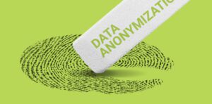
Anonymize or de-identify data when necessary to protect the privacy of individuals. Remove or obscure personally identifiable information (PII). Consider aggregating data to reduce granularity and minimize the risk of re-identification. For example, when sharing geospatial data related to public transportation, anonymize passenger data and provide aggregated information about passenger volumes at various stops without revealing individual details.
3. Data Transparency and Quality
Provide clear information about the sources of your geospatial data, data quality and any limitations. This transparency therefore allows users to assess the reliability of the data. For example, when publishing a geospatial map displaying air quality, include a legend that explains the data sources, the measurement units used and the date of the data collection.
4. Data Security and Protection
It’s crucial that you implement robust data security measures to protect geospatial data from unauthorized access and data breaches. You should therefore encrypt data in transit and at rest. Set access controls to limit who can access and manipulate the data. Conduct regular security audits to identify and address vulnerabilities. For example, if you’re managing a geospatial database for a government agency that contains sensitive infrastructure information, encrypt the data and restrict access to authorized personnel only.
Read Also: What is Data Protection and Why is it Important
5. Community Engagement and Stakeholder Feedback
Engage with stakeholders, including local communities, when undertaking GIS projects that may have a significant impact on their privacy or well-being. Hold public meetings, gather feedback and involve stakeholders in decision-making processes. Address concerns and incorporate community input into project design and execution. For example, when planning a large-scale construction project that affects a residential neighborhood, organize town hall meetings and involve local residents in discussions about the project’s scope, timeline and potential disruptions.
Key Take-Aways
Geospatial ethics are not merely a theoretical concept; they are the foundation of responsible and ethical GIS practices. Neglecting these ethical considerations can lead to violations of privacy, legal repercussions, environmental and social harm, and a loss of public trust in the field of GIS. As professionals, considering geospatial ethics is not just a choice; it’s a moral obligation. By adhering to ethical principles, GIS practitioners can harness the power of geospatial data for positive change while safeguarding the privacy, security, and well-being of individuals and communities. It is only through this commitment to geospatial ethics that the true potential of GIS can be realized in an ethical, responsible, and sustainable manner.
I’m a passionate communications professional with a flair for crafting compelling brand stories and driving impactful communications and marketing campaigns. With a background in public relations (PR) and marketing, I help shape narratives in today’s fast-paced digital landscape.


Comment here